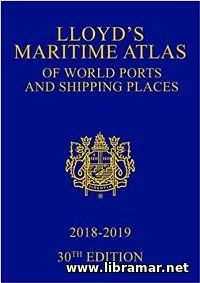
LLOYD'S MARITIME ATLAS OF WORLD PORTS AND SHIPPING PLACES 2018—2019

| Author(s) | Informa UK Ltd |
| Publisher | Informa Law from Routledge |
| Date | 2018 |
| Pages | 178 |
| Format | |
| Size | 29 Mb |
| D O W N L O A D | |
The LMA has been published for nearly seventy years and is the oldest and the most respected atlas among those used in the maritime industry. This Atlas is released to provide users with a comprehensive reference source for locating the ports and shipping places of the world, the information contained in the Atlas includes the main connections together with the canal and river systems considered major.
All commercial ports included in the publication have been covered in a very clear and concise way; the authors of the title have mainly focused on the busiest world trade routes. In addition to that, the book features both regional and world marine distance tables together with the comprehensive user guide, and statistics on the movements of the commercial ships, causalities and characteristics.
The most important and advantageous features of the current release of the Atlas include the top twenty marine ports with the statistics and informative illustrations, completely updated world maps covering the no-go shipping areas due to the ebola, precise longitude/latitude coordinates of more than eight thousand ports/shipping places, newly established indexing systems that allows readers to perform both alphabetical and geographical search and view the main features of each of them covering the LNG imports and exports.
The "Read Later" function allows you to add material to this block with just one click. Just click on the icon and read the articles that interest you at any convenient time.


