Navigation & Seamanship

04.10.2017
RYA YACHT MASTER SAILING COURSES

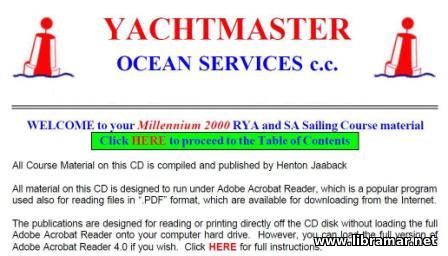
Here is an excellent compilation of all training course material provided by RYA and published by Henton Jaaback, that is intended to provide all required information to the beginner yachters but shall also be useful for the persons with considerable yachting experience. All files included in the pack are in pdf format making it easy to opened on any computer and mobile device without having to install any additional software.

The pack include the Marine Radio Operator Certificate and Competent Crew and Yacht Skipper courses, all four parts of the Coastal Skipper and Yachtmaster Offshore course and both parts of the Yachtmaster Ocean course. There are all required nautical tables included for ready reference. The tutorial presentation contained in the set address the meteorology and COLREGs, supplemented by the Onboard Skipper Prompts. There are also numerous self-test questions for the yachtsmen with the answers to track the learning progress.

Several mandatory nautical publications have also been included by the compilers of this pack, as well as a wealth of other supplementary information and publications making this training pack a must-have one for all persons interested in yachting regardless of their level, skills and experience.
4932 Viewing 0 Comments Read more
01.10.2017
WEATHER WATCHER

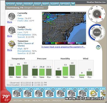
The weather watcher is quite compact but very useful program developed to allow users to automatically retrieve all weather data at pre-set intervals; the software features the display of the current weather condition and temperature in a tray icon. the users are enabled to designate which of the weather information will be displayed in the tray.

Another useful function of the Weather Watcher is the conversion of all weather data, logging subject data and exporting it in any desirable format. There are several other options which you will see once you have installed the program and start using it. We would note that the program interface is simple and easy-to-use by all people and there are so many ways to customize it as you wish.

An absolutely needful and recommended program which may be used as a supplementary weather informer on the vessel and may actually be installed on any computer. No need for any cracking or activation, the program will be ready for use once it has been launched on any Windows platform.

5313 Views 0 Comments Read more
28.09.2017
PC SIGHTMASTER

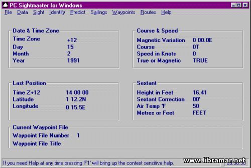
This software was developed to work on all Windows platforms - PC Sightmaster is a very compact and user-friendly program; however, note that it is advanced enough to be used for the ocean navigation on the computers. The content was prepared having the end users and their convenience in mind and provides a broad selection of all required functions accompanied with the remarkably extensive on-screen help and guidance, intuitively understandable buttons and input boxes.

One of the features of this application is that it includes memory of all user's navigational data, i.e. the speed, course, last position and past sights, height of eye, routes and waypoints, date etc. The Identify feature is implemented to provide users with the star or planets name from estimated bearing/altitude. The developers have implemented the functions of compass correction and export of waypoints/routes to the plain .txt file for their further inclusion and use in the other programs. Compact and easy-to-use even for the non-professionals. No viruses/malware.

4730 Views 0 Comments Read more
28.09.2017
WXTIDE32 — TIDES AND CURRENTS

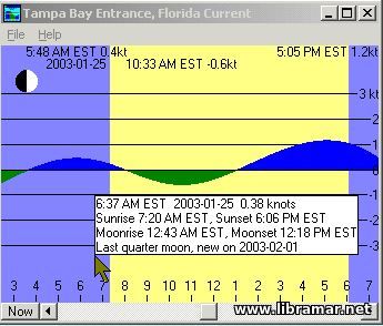
WXTide 32 is one of the most popular and simple programs used for the tide and current prediction. It can predict tides from 1970 to 2037 using almost ten thousand stations (including 160 of them located in United Kingdom) and, in addition to that, more than three hundred tidal current stations.

The software has originally been developed for the interactive use; however, it can be easily used from other programs. Each of the graphic modes features separate display options as well as window settings. The users are now enabled to add custom tides and subordinate stations.

Taking into account the fact that this software is intended for free distribution, there is no need to crack it or pay for any additional codes or installation passphrases. We would highly recommend this compact yet useful program for both practical use and for training purposes. The software is fully self-contained, it means that nothing else is required. It has been tested and proven workable on all Windows platforms.

4743 Viewing 0 Comments Read more
24.09.2017
OPENCPN V.4.8.0 STABLE FOR WINDOWS AND MAC OS

This very latest stable 4.8.0 release of the open-source OpenCPN software intended to be used for the marine navigation and work on Windows and Mac. The huge number of features of this nav software includes waypoint navigation, route navigation with enabled vessel tracking function, single-chart, quilted and moving-map display modes, support of the autopilot output, anchor watch, alarm functions, incorporated great circle routing, various display themes, as well as numerous plugins and AIS support; this program was developed to support BSBv3 raster and S57 nautical charts as well as CM93 vector charts; BSB4 and NV-chart formats may also be supported by using appropriate plugins.

In short, all available plugins and chart support have been included in the pack. The developers provided the multi-language support including more than twenty languages. There is no need for any type of activation or registration. Nor you will have to send messages to activate it. Note that we have the android app also available. In addition, note this pack includes all files to work on both Windows and Mac platforms.

4193 Viewing 0 Comments Read more
22.09.2017
NAUTICAL CALCULATORS

Here is a brilliant compilation of thirty three nautical calculators that have been specifically collected in one folder for users convenience. These calculators may be used for solving nautical equations and conversions; they may also serve as a practical reference material for the navigator.

Each of the pages represents one self-contained JavaScript program. There is no need to install anything. the only thing user is expected to do is to open a corresponding file and start making calculations.

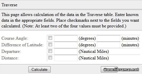
The calculators contained in the set may be used for calculating altitude correction and air temperature, relative humidity and dew point, altitude correction for atmospheric pressure, geographic range, speed for measured mile, traverse, distances, compass error from amplitudes observed on the visible horizon, longitude and latitude factors, great circle sailing, barometer measurement conversions and do so many other calculations. Note that the size of the set is next to nothing so just download it and save somewhere for the future use if required.

3889 Views 0 Comments Read more
17.09.2017
MARINER'S OFFICE 5.1

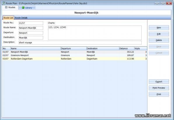
This relatively compact but very useful software is very user-friendly and specifically designed to be used when performing draft surveys, passage panning and conducting the lashing calculations intended to help Ships' Officers as well as Marine Surveyors.

The program Mariners Office is easy to operate using either computer mouse or keyboard and complies with all recently released United Nations ECE standards and Maritime Safety Committee 2013 edition of the "Code of Safe Practice for Cargo Stowage and Securing" applicable to the draught surveying.

Note that the results obtained during the calculations can easily be printed to virtually all standard printer types so that you have a hard copy. An excellent application which we would recommend you to have readily available in case you intend to plan your future passage, perform the draft survey or calculations associated with the lashing.

5957 Views 0 Comments Read more
17.09.2017
MARITIME COMMUNICATIONS

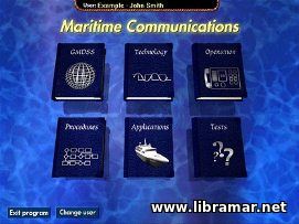
The Maritime Communications software is designed to be run on both Windows and Mac platforms, which is one of its advantages. This is a very useful interactive multimedia application used to attain and refresh your knowledge of GMDSS. The software is aimed to give the user necessary theoretical knowledge to pass the GOC, standing for the General Operator's Certificate examination.

The program contains various relevant photographs, text and narration guides, and even interactive animations included make it more user-friendly and let the users easily get much better understanding of GMDSS. Absolutely recommended for all persons engaged in ship navigation, radio communications and operation or maintenance of the GMDSS-related radio equipment on board the ship, they will find all information they need in this program and may consider themselves duly trained, subject to the satisfactory completion of all modules.

7989 Views 0 Comments Read more
« 1 2 3 4 5 6 »
Enter the site
Read Later

    The "Read Later" function allows you to add material to this block with just one click. Just click on the icon and read the articles that interest you at any convenient time.

Top Posts
Rate my site