Nautical Charts & Tables

24.09.2022
HOW TO READ A NAUTICAL CHART

The volume will provide you with the clear and detailed explanations of all important aspects of both paper and electronic nautical charts, giving the practical and authoritative information. You will get to know how the nautical charts are assembled and how their accuracy should be assessed; the due attention has been paid to the nautical charted developed by the other countries, etc.

The author will teach the readers what they should do in order to squeeze literally everything from the available charts including the vector and raster nautical charts. This second edition of the world popular title is intended to covers all recent changes in e-charting, radar overlays, integrated systems installed on board ships, automatic identification systems, together with their interfacing. The rapidly developing 3D technology has also been dealt with. The instructions given by the author will definitely assist and contribute in the safety of navigation.

Even if you are not professional navigator, this book will be of interest to you as it also gives some background of the nautical charts, how and where they were first developed and what is the proper way of using them. It is very important to understand how the inaccuracies appear on the charts and the consequences they can have, and this is particularly addressed by Nigel Calder.
2723 Viewing 0 Comments Read more
10.06.2021
REEDS MARINE DISTANCE TABLES

This is an excellent and world class publication, a truly must-have for all navigators of today; in fact, it will be interesting and useful not only to the ship masters but also to the owners, and anyone else involved in planning the voyage. The text of the publication will provide mariners with the clear and easy-to-use information and all required support so that they can properly calculate the best, meaning both shortest and economical, distance between any ports.

The content of the volume is presented in accordance with the market areas. The volume includes numerous and very informative data tables and illustrations, maps and lots of other supplementary information. According to the reviews received from different parts of the world, the publication shall be treated as one of the most valuable reference sources for the people in the shipping industry.

Note that it is becoming increasingly popular among the superyacht fleet owners, brokers and of course navigators who have already appreciated the comprehensiveness and user-friendliness of the volume – the author managed to collect enormous amount of useful information and arrange it in a maximum comfortable way. All ports regularly used for commercial shipping are covered.

2048 Views 0 Comments Read more
10.06.2021
THE EXCELSIOR AZIMUTH AND POSITION FINDING TABLES

The main objective of the tables contained in the present classic publication was to provide ship navigators with better means to find the position of their ships through analyzing the sun, starts and moon altitudes. The information was compiled by the professional mariner possessing great practical seagoing experience and so many real-life observations. Traditionally for this sort of publications, the volume opens with the explanations and use of the tables – this is necessary to enable the readers to get maximum use of the content.

This chapter is followed with the one containing general rules and examples and also valuable remarks including calculation formulae and position finding rules. Then, there are dozens of practical examples of applications of the tables when navigating and this is where the introductory part of the book ends. The tables themselves make the major part of the book. The volume will be interesting for the people fond of marine navigation, who not only want to navigate their vessels safely but also need to have a good picture of the underlying essentials and some historical background – it would be good to know how all these were handled in not so distant past.

1054 Viewing 0 Comments Read more
10.06.2021
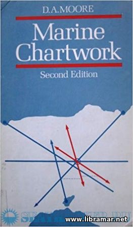
MARINE CHARTWORK

The history of marine navigation starts from the use of the ancient landmarks to the contemporary sophisticated techniques of e-navigation, embracing a science featuring so many different facets. The main purpose of the present volume is to demonstrate the fundamental principles of sailing to the students preparing for the GCE and RYA/D.Tp. exams. The content of the publication covers the respective syllabuses.

The volume will definitely prove very valuable to the practicing yachtsmen willing to venture well beyond the home estuary. The author has provided thorough explanations of the basic principles of finding the position of the ship and plotting the lines. The theoretical part of the publication is supplemented with numerous worked examples making the understanding of the content much easier.

There are many informative illustrations and data diagrams included. The efforts made by the author have eventually resulted in this brilliant book which has already been appreciated by the navigators all around the world. It is excellent for self-training and classroom, regardless of the knowledge and practical experience you have, it will contribute in the improvement of your navigation skills.

3069 Views 0 Comments Read more
10.06.2021
THE COMPLETE NAUTICAL ASTRONOMER

The navigation is usually referred to as a sort of maritime art used by the mariners to get their vessels from one point of the world to another in a safe and expeditious manner. The traditional ways that are available to the marine navigators to check the progress of their ship are all based on the fundamental principles of the astronomy. These methods of mathematical astronomy shall be used by the mariners if the conventional shore observations are not available or electronic aids are not functional.

And this is the nautical astronomy which is scientific in nature. The author's aim in preparing this volume was to provide navigators with the complete and up-to-date reference book on nautical astronomy and fill the gap in the literature currently available on the modern navigation needs. The author has introduced some historical background intended to broaden the knowledge of the readers in the field of navigation, and will also definitely enhance their interest in navigation.

The author hopes that the people who have read this book including both amateur and professional mariners will gain real profit from the information and instructions contained in its pages. Moreover, they will find it very enjoyable to get better understanding of the subject.

1343 Viewing 0 Comments Read more
10.06.2021
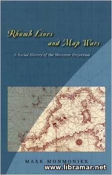
RHUMB LINES AND MAP WARS

This is a really rewarding study of map preparation and practical use of maps. The book is intended to offer readers an excellent and very valuable contribution to the cartography. The author has clearly explained the effective established methods of delineating the round earth on a piece of paper that is flat, and these methods have been developed over past four centuries.

The text is rich of clear and informative data diagrams showing every single stage of human's attempts to solve that problem. Though the book is not that big, its content present a very good combination of various elements, such as the usefulness and readability. Note that this is not a textbook on map projection; however, is shall definitely be used as a very handy introduction to this subject because of the amount of the relevant information that will be most probably needed by the non-specialists. There are two sources of fear for the mariners - to get lost and to face a bad weather, and that is why the maps are considered critically important for any mariner.

The publication starts with the introduction followed by the chapters covering the Mercator's resume and early sailing navigation charts, revealing replicas and writing approach, soldiering on, wall maps, worldviews and other relevant areas. The book is very readable and is expected to be used by all people with the interest in the field.

2738 Views 0 Comments Read more
10.06.2021
MAP PROJECTIONS — A REFERENCE MANUAL

The Manual is discussing both theory and different practical problems of map projections together with their development and application to the map design. The authors have made a brilliant attempt to provide readers with the results of years of professional research and experience of many specialists in this fields in a brief and systematical manner. Subject experience relates to any individual working on preparation of the maps; in fact, this is a very first international textbook on the subject using the experience of American and Russian specialists.

The volume may serve as a remarkably precise handbook or practical manual to be used by engineers, scientists and cartographers o solve the practical problems using the methods of mathematical cartography and space imagery. It may also be used for training purposes in the colleges or even for the self-study. The effective solution of the problems relating to the science and commerce is based on a broad use of the maps prepared in various scales, having various contents and released for various purposes.

The publication provides information on the general theory, projections with straight parallels and with parallels in concentric/non-concentric circles, relevant researches, established numerical methods, identification and choice of the projections and many other useful and practical information.

3219 Views 0 Comments Read more
10.06.2021
NORIE'S NAUTICAL TABLES

A world famous set of mathematical tables which was initially published more than a century ago and has been  a real bestseller ever since the time of first release. In fact, these tables still remain a fundamental requirement for any person learning the astro-navigation and practicing it, despite all developments if the field of electronic navigation.

Captain Blance, who is the author of the title, has spent a lot of time working on modernization of the tables for the present edition. Some completely new tables have been added while obsolete tables have been deleted in order to fully conform with constantly changing navigation techniques and aiming to improve the accuracy of the calculated position of the vessel plus to reduce the tedium of the these calculations. The volume includes all tables necessary for both deep sea and coastal navigation. The author has applied a simple uniform interpolation method for all tables with trigonometric data.

Note that the volume also includes several tables that are commonly not readily available on the navigation bridge of vessels or ones usually used only in the exam rooms. The author has also completely restructured and significantly updated the section of the book dedicated to the sea ports. All of the ports have been listed geographically in the special order. The index of all addressed sea ports in there at the back of the section.

32911 Views 0 Comments Read more
1 2 3 ... 10 11 »
Enter the site
Read Later

    The "Read Later" function allows you to add material to this block with just one click. Just click on the icon and read the articles that interest you at any convenient time.

Top Posts
Rate my site